 To
equate the region of Los Angeles to that of the Bypass East is tough at first
until one starts to look at the ruggedness of the terrain both reside in. The
mountains that surround the L.A. Basin are just as rugged as the coastline of
Maine, the terrain is different, although it is a rugged land. To the
right are the snow capped San Gabriel Mountains.
To
equate the region of Los Angeles to that of the Bypass East is tough at first
until one starts to look at the ruggedness of the terrain both reside in. The
mountains that surround the L.A. Basin are just as rugged as the coastline of
Maine, the terrain is different, although it is a rugged land. To the
right are the snow capped San Gabriel Mountains.

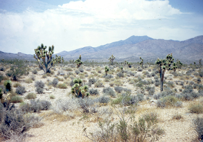
On the backside of the San Gabriel Mountains to the North and East is the vastness of the Mojave desert and the Antelope Valley.
The Mojave covers over 54,000 square miles and it's topography is typically related to the Basin Range.

Many parts of the Mojave typically range from highs of around 95-105F in the summer to lows of around 20-30F in the winter.The Mojave Desert receives less than 6 inches of rain a year and is generally between 3,000 and 6,000 feet in elevation.

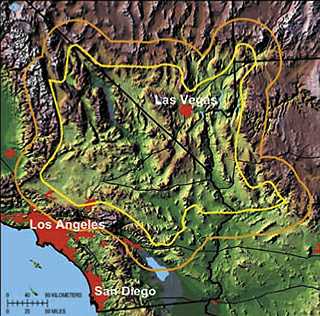
Essentially, Los Angeles is surrounded by high Mountains, a huge desert to the East, and the vastness of the Pacific Ocean to South and West. This isolates Los Angeles from the rest of the country and because of its geographic location it almost seems like its is an island.
Sources:
National Parks Service, U.S. Department of the Interior, Mojave
http://www.nps.gov/moja/index.htm
No comments:
Post a Comment