Varied Topography
 When explaining the topography of Los Angeles one just has to turn on the local news and watch the weather report. They usually have three different reports for these micro-climates, the deserts and mountains, valleys and foot hills, and finally the coast, although it could be broken up into five distinct micro-climates when adding the high and low deserts.

The varied topography dictates these climates and there are times in the summer when it is 65 degrees on the coast and it is 110 in the desert.

The coast is tempered by the Pacific Ocean and the swings in temperature are usually very small. The average temperatures are around 61 to 65 degrees


In the the San Gabriel Mountains, which are only 25 to 50 miles away from the ocean and rise to their highest point at Mount San Antonio (Mt Baldly) at 10,064 feet.

The average temperature can fluctuate from the 30s to mid 40s in winter and exceed 90 degrees in the peak summer months.
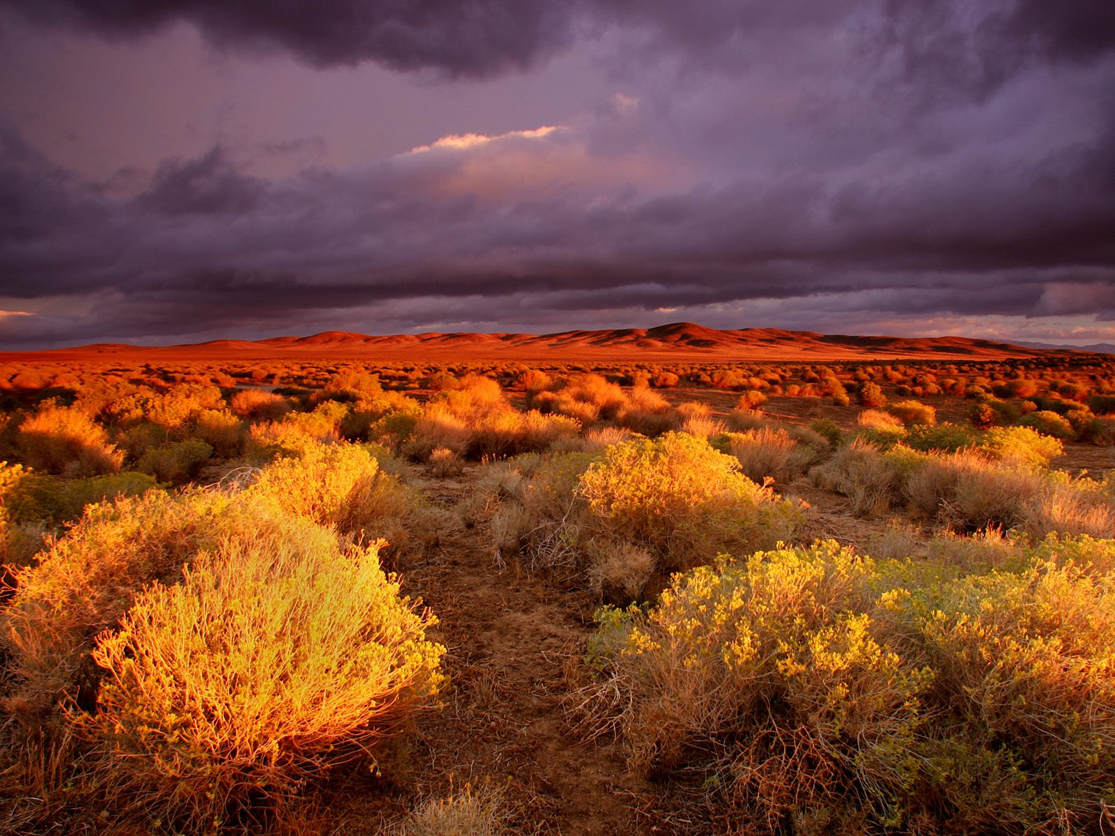
The High Desert the average daily temperature is 61 degrees and this has allot to do with its elevation, which ranges between 2,500 to 3,975 feet above sea level. The average daily temperature from July to August is 94 degrees, while in winter the daily average high is right around 62 degrees and lows can reach into the 20s and occasionally lower at night.

The Low Desert has the most extreme temperatures and climate. Geographically, this region consist of the portions of the Colorado, Sonoran, and Yuha Deserts and because it is in the rain shadow of the traverse and peninsula ranges of Southern California the amount of rain received by this region is less than 5 inches a year. The winter months are warm and mild with highs between 73 and 86 degrees, while summers can feel as though Satan himself was on vacation there with temperatures eclipsing 120 degrees on a regular basis.
Sources:
Mt. Baldy-Wrightwood, California
http://www.city-data.com/city/Wrightwood-California.html
The Weather Channel
http://www.weather.com/outlook/recreation/outdoors/wxclimatology/monthly/graph/USCA1263
NOAA
http://graphical.weather.gov/sectors/southcalifornia.php
No comments:
Post a Comment